|
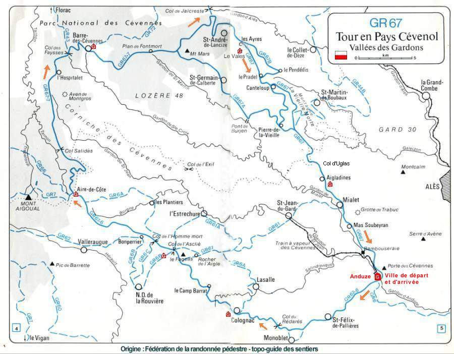
Day 1) Anduze – Colognac 5 h 30
2 ) Colognac – Mas Corbières 4 h 45
3 ) Mas Corbières – Aire de Côte 5 h
4) Aire de Côte - Barre des Cévennes 7 h
5) Barre des Cévennes - Les Ayres 7 h
6 ) Les Ayres - Les Aigladines 6 h
7 ) Les Aigladines - Anduze 5 h
( strong walkers might consider combining days 2 and 3 taking about 8 h )
The tourist Office in Anduze offers a special part containing IGN maps and a photocopy of the topoguide for 28 euros .
You can also get futher information about aspects of the walk from Sebastien at the Gîte d’Etape d’Anduze. Tel : +33 (0)4 66 61 70 27
-
The GR67 Tour des Cévennes is a 140 kms long trail which begins and ends in Anduze, where you’ll find a welcoming base at the Gîte d’Etape d’Anduze. The Cevennes National park is classified as a World Biosphere Reserve since 1985. The park runs along open ridges and through many forests while also following ancient drove roads . It rises to a height of 1120 metres. Although there are few sustained ascents, but there is a considerable amount of up and down, making this a fairly demanding route.
-
Accomodation can be found many gites d’etape throughout the route. These Gites usually offer evening meals and breakfast at around 40 euros per person though several have self-catering facilities.
-
Itinerary :
|
|